

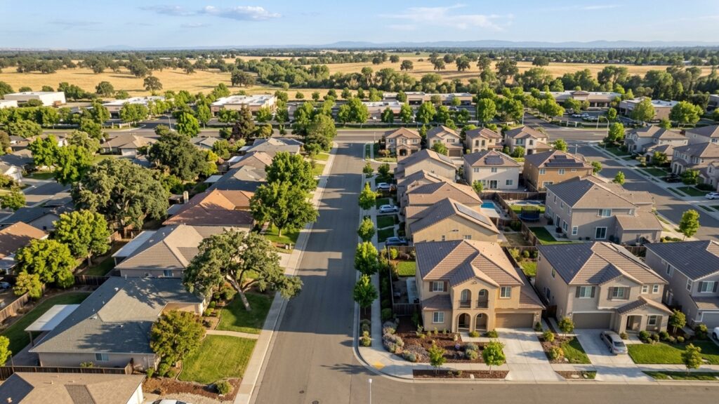
Roseville, CA sits in the Sacramento Valley as one of Placer County’s biggest residential and commercial hubs. The local market currently carries a median sale price of approximately $645,500, with homes spending roughly 23 days on the market before selling. When buying a home in Roseville, CA, postal codes are usually the first tool you reach for – different zip codes mean different neighborhoods, different price points, and different property types.
Knowing which zip code covers which part of the city makes it easier to track inventory, compare values, and understand where a listing sits relative to employment centers and retail corridors. Roseville falls within the Sacramento-Roseville-Folsom Metropolitan Statistical Area, and that regional context matters when you’re reading market data. Getting your postal boundaries straight from the start saves a lot of confusion later.
Primary Postal Codes Serving Roseville, CA
The United States Postal Service assigns several zip codes to the Roseville area to handle mail delivery across what’s become a fast-growing city. The central and historic parts of the city primarily fall under 95678. That area carries a mix of older, established neighborhoods alongside commercial corridors that have been there for decades.
As the city pushed outward, new postal routes followed – covering the western and northern developments that didn’t exist a generation ago. Real estate listings will generally display one of these dedicated codes, which immediately tells you what quadrant of the city you’re looking at. Right now there are 372 homes for sale across the entire Roseville market, distributed among these different delivery zones.
Complete List of Roseville Zip Codes and Coverage Areas
The 95678 zip code is the one you’ll see most often – it covers the central core and shows up constantly in listing searches. Properties here recently sold at about 99.5% of their list price, which tells you this isn’t a market where buyers are extracting big discounts.
Postal boundaries, though, don’t line up perfectly with city limits. The broader Sacramento-Roseville-Folsom Metropolitan Statistical Area uses plenty of other codes for adjacent towns and unincorporated pockets of Placer County. Some addresses that carry a Roseville designation share a zip code with a neighboring community – which is worth knowing before you assume a listing sits exactly where you think it does.
The 95678 Delivery Area
Properties within 95678 run the full range of housing types, from single-family homes to townhouses, across a central location with direct access to municipal services and established infrastructure.
Sellers here benefit from the strong demand that runs throughout Placer County. With roughly 554 homes sold recently across the city, properties in the central postal zone that come in at the right price don’t sit around long.
Overlapping and Adjacent Delivery Routes
Mail delivery routes routinely cross city lines into surrounding Placer County areas. A home can carry a Roseville mailing address while physically sitting in an adjacent jurisdiction – it’s more common than most buyers expect.
If city services or specific zoning regulations matter to you, verify the exact municipal boundaries independently. Postal codes route mail; they don’t define tax assessment districts or city voting wards.
Defining the Roseville Zip Code Boundaries
Postal boundaries in Roseville are largely shaped by major roadways, natural features, and large commercial developments. The most prominent geographic anchor in this system is the Westfield Galleria at Roseville – a retail hub with over 1.5 million square feet of shopping space that effectively divides the surrounding districts.
Arterial roads do most of the work separating one zone from another, which means that once you know the major corridors, you can usually make a reasonable guess about which code a property falls under without pulling up a map.
Landmarks and Road Divisions
The Westfield Galleria at Roseville is hard to miss as a boundary marker – its footprint is large enough that traffic patterns around it function as natural dividing lines between neighborhoods. Routing decisions follow where the people and the roads go.
Other boundaries track the contours of the Sacramento Valley landscape or run along major highway corridors. These physical markers are what make the delivery zones feel logical rather than arbitrary once you spend some time in the city.
Neighborhood Alignments
Most specific neighborhoods fall entirely within a single zip code, though larger master-planned communities can occasionally straddle two. Well-known areas like Westpark Village, Highland Reserve, and Olympus Pointe/Lead Hill each sit within distinct geographic pockets of the city.
Subdivisions like Morgan Creek Village, Fiddyment Farm, Diamond Oaks, and Woodcreek Oaks follow similar routing patterns. For most buyers, the postal code is a reliable filter when searching for homes in a particular neighborhood online.
Placer County and Regional Context
Roseville sits entirely within Placer County – full stop. That county designation controls property tax collection, deed recording, and the office you’ll be filing paperwork with when you close. That’s the Placer County Assessor’s Office.
The city also anchors the Sacramento-Roseville-Folsom, CA Metropolitan Statistical Area, which reflects how economically connected Roseville is to the broader Greater Sacramento region.
The Greater Sacramento Area Connection
Being part of the Greater Sacramento metropolitan area means Roseville shares both a regional housing market and a commuter base with the state capital. A significant number of residents cross county lines for work, which makes highway infrastructure a real factor when buyers are weighing neighborhoods.
That regional integration supports property values here. With only 2.1 months of housing supply currently available, this remains a seller’s market – inventory is tight and has been for a while.
Neighborhoods by Zip Code
Roseville covers a lot of ground, from historic downtown streets to large-scale new construction developments on the city’s edge. The 95678 zip code handles much of the central and older sections of the city.
Further out, residential subdivisions take over. Areas like Johnson Ranch offer distinct housing styles, and the city includes communities built around specific demographics and lifestyle preferences.
Central and Commercial Districts
The downtown area and the neighborhoods surrounding the Westfield Galleria at Roseville form the commercial heart of the city. These districts offer higher-density options – condos and apartments alongside traditional single-family homes – for buyers who want retail and dining within easy reach.
Shorter drives to major shopping centers and local amenities are a straightforward trade-off for the density that comes with living in these central postal routes.
Residential Subdivisions and Active Adult Communities
Sun City Roseville is the name that comes up most often in this category – a 55+ active adult community with over 3,300 homes, two golf courses, and a central clubhouse. It’s a significant development that draws buyers specifically seeking that lifestyle.
Beyond Sun City, master-planned areas like Fiddyment Farm and Westpark Village represent the city’s outward expansion in recent decades. These neighborhoods typically feature newer construction, larger lot sizes, and community-managed amenities.
Telephone Area Codes for Roseville
Phone area codes are another geographic identifier that new residents ask about. Roseville historically used a single primary area code for landlines and registered mobile numbers within the city limits.
As the Sacramento-Roseville-Folsom Metropolitan Statistical Area grew, telecommunications providers introduced overlay codes to meet demand for new numbers. New residents setting up local utilities or business lines will receive numbers from the current regional overlay pool.
Finding Your 9-Digit Mailing Address
The standard five-digit zip code gets your mail to the right Roseville post office. The full nine-digit ZIP+4 code takes it further – specifying the exact delivery route, down to a specific block, apartment building, or cluster of mailboxes.
Real estate transactions, mortgage applications, and utility setups often require the full nine-digit code for precise address verification. Getting it right means property tax bills and official county correspondence don’t get delayed or misrouted.
Using the USPS Lookup Tool
The most accurate way to find your ZIP+4 in Roseville is through the official United States Postal Service website. Enter a street address into the USPS ZIP Code Lookup tool and it returns the exact nine-digit number.
This is especially useful for buyers purchasing new construction in areas like Fiddyment Farm or Westpark Village. Newly built streets can lag behind in postal routing updates, so the official USPS database is the only source worth trusting for verification.
Why the Extra Digits Matter
Lenders and title companies use the ZIP+4 to pull accurate property data and confirm flood zone designations. A missing or incorrect extension can flag an address during underwriting – a minor problem that’s easy to avoid.
Homeowners setting up new utilities with Placer County providers should also use the full nine digits. It streamlines account creation and prevents billing errors when multiple streets in the area share similar names.
Real Estate Market Data by Zip Code
Tracking housing data by zip code gives you neighborhood-level pricing rather than just a citywide average. Across all of Roseville, the median sale price is approximately $645,500 – but that figure moves depending on which postal zone you’re looking at.
The market is moving at a steady pace, with homes spending roughly 23 days on the market. Nearly 33% of recently sold homes closed above their original asking price, so buyers who come in unprepared for competition tend to lose out.
Current Housing Inventory and Prices
About 372 homes are currently available for sale across the city – a 2.1-month supply, which puts this squarely in seller’s market territory. That’s not a lot of options when you’re actively searching.
Properties in neighborhoods like Highland Reserve or Diamond Oaks frequently draw multiple offers. The citywide average sale-to-list ratio of 99.5% confirms that sellers here are generally getting what they’re asking.
Finding the Right Area for Your Budget
Comparing price per square foot across different Roseville zip codes is something worth doing with a local agent who knows where the value sits. Older neighborhoods can offer more accessible entry points, while newer developments like Morgan Creek Village often carry a premium.
Local property taxes paid to Placer County and HOA fees in communities like Sun City Roseville both affect your monthly number. Factoring in the total cost of ownership – not just the purchase price – is how you avoid surprises after closing.
Frequently Asked Questions
How many zip codes does Roseville, CA have?
Roseville uses multiple zip codes across its city limits and surrounding areas. While 95678 is the primary code for the central district, the exact number of codes serving the city changes as the USPS updates delivery routes for new developments.
What is the best zip code to live in Roseville?
That depends entirely on what you’re looking for. Buyers seeking 55+ amenities often focus on the area covering Sun City Roseville, while those who want immediate retail access tend to target the 95678 zone near the Westfield Galleria.
Where is zip code 95678 in Roseville, CA?
The 95678 zip code covers the central portion of Roseville, including historic downtown streets and major commercial centers in the Sacramento Valley.
Do Roseville zip code boundaries determine my assigned school district?
No. Postal boundaries have nothing to do with school district assignments. Attendance zones are drawn independently by local education boards and frequently overlap multiple zip codes.
What county is Roseville in?
Roseville is located entirely within Placer County. Property records, tax assessments, and deed recordings for the city are all handled by Placer County offices.
How do I find my full 9-digit (ZIP+4) code in Roseville?
Enter your street address into the USPS ZIP Code Lookup tool online. The full nine-digit code is what lenders and title companies use to verify your property details during a purchase.
What is the Roseville area code?
Roseville uses the area codes assigned to the broader Sacramento-Roseville-Folsom Metropolitan Statistical Area. New phone lines will receive numbers from the current regional overlay pool covering Placer County.