Located just northeast of Sacramento, Roseville stands as the largest city in Placer County. Buyers looking at the region frequently want to understand the local infrastructure, commuting patterns, and housing market before making a move.
Relocating requires looking past the marketing brochures and focusing on the concrete numbers that impact daily life. When buyers ask if Roseville, CA is safe, the most accurate answer requires reviewing objective data rather than relying on subjective opinions.
This guide provides verifiable crime, real estate, and infrastructure statistics for 2026. By examining these metrics, prospective homeowners can make informed, confident decisions about purchasing property in this Northern California hub.
Analyzing Roseville, CA: Objective City Profile and Safety Data
Real estate professionals evaluate a city by examining its core civic infrastructure alongside municipal data. Roseville operates with a distinct separation from Sacramento, maintaining its own utility services, law enforcement, and city planning departments.
Understanding this separation is crucial for buyers calculating long-term property values and municipal benefits. A city that manages its own resources often displays different growth patterns and municipal response times than areas reliant on county-level services.
We rely on current public records, state reporting, and verified municipal databases to build a clear picture of the city. This data-first approach ensures buyers have a factual baseline when evaluating different neighborhoods across the region.
Roseville, CA Crime Statistics and FBI Data
Evaluating public safety requires looking directly at the numbers provided by state and federal databases. According to recent municipal reports and data releases heading into 2026, the violent crime rate in Roseville is approximately 3.08 per 1,000 residents.
This translates to roughly a 1 in 454 chance of experiencing a violent crime, which tracks lower than the California state average. Property crime, which includes vehicle theft and burglary, presents a different statistical picture for local homeowners.
The chance of experiencing a property crime in the city is approximately 1 in 69. For buyers, these statistics highlight the importance of standard home security measures, particularly in subdivisions located near major retail corridors.
Public Safety and the Roseville Police Department
The Roseville Police Department handles local law enforcement and maintains a strong focus on community transparency. The department actively publishes data through an online public crime map and a regularly updated crime log.
This level of accessibility allows residents to monitor reported incidents block by block in real time. Buyers can use these municipal tools to verify the specific incident history of a street before submitting an offer on a house.
The department also operates specialized units dedicated to traffic enforcement along the busy commercial corridors. A well-resourced local police force generally correlates with stable property values, as buyers prioritize areas with responsive civic services.
Healthcare Infrastructure: Sutter Roseville Medical Center and Kaiser
Access to major medical facilities is a major driver of real estate demand in Placer County. Sutter Roseville Medical Center serves as a primary local facility, offering a Level II trauma center and extensive specialized care units.
Kaiser Permanente also maintains a massive footprint in the city, operating a comprehensive medical center and several satellite clinics. The presence of these two major healthcare providers ensures residents have immediate access to emergency services without traveling to Sacramento.
Properties located within a short drive of these medical campuses often see sustained buyer interest. The concentration of medical infrastructure also provides a strong local employment base, which supports the surrounding housing market.
Public Parks and Recreational Facilities
The physical infrastructure of Roseville includes an extensive municipal park system integrated directly into the residential zoning. The city maintains over 80 public parks, ranging from small neighborhood green spaces to massive regional complexes.
Mahany Park spans roughly 200 acres and includes a library, an aquatic center, and extensive sports fields. Similarly, Maidu Regional Park offers 150 acres of community center facilities, walking paths, and historical exhibits.
Buyers frequently prioritize homes located near these larger recreational hubs. The city’s commitment to maintaining these spaces indicates strong municipal funding and adds measurable value to the local real estate market.
Transportation and Commute Times via I-80 and Highway 65
Commuting logistics play a massive role in where buyers choose to purchase a home in Northern California. The standard commute to downtown Sacramento typically takes 25 to 40 minutes, depending heavily on the time of day and traffic conditions.
Regional travel is anchored by the Highway 65 and I-80 interchange, which is a known traffic bottleneck. Navigating this specific interchange during peak rush hour can easily add 10 to 20 minutes to a daily drive.
For those traveling further distances, I-80 provides direct access to both the Sierra Nevada mountains and the coast. Driving to the Bay Area generally takes between 90 and 120 minutes, making it highly accessible for hybrid workers who only commute occasionally.
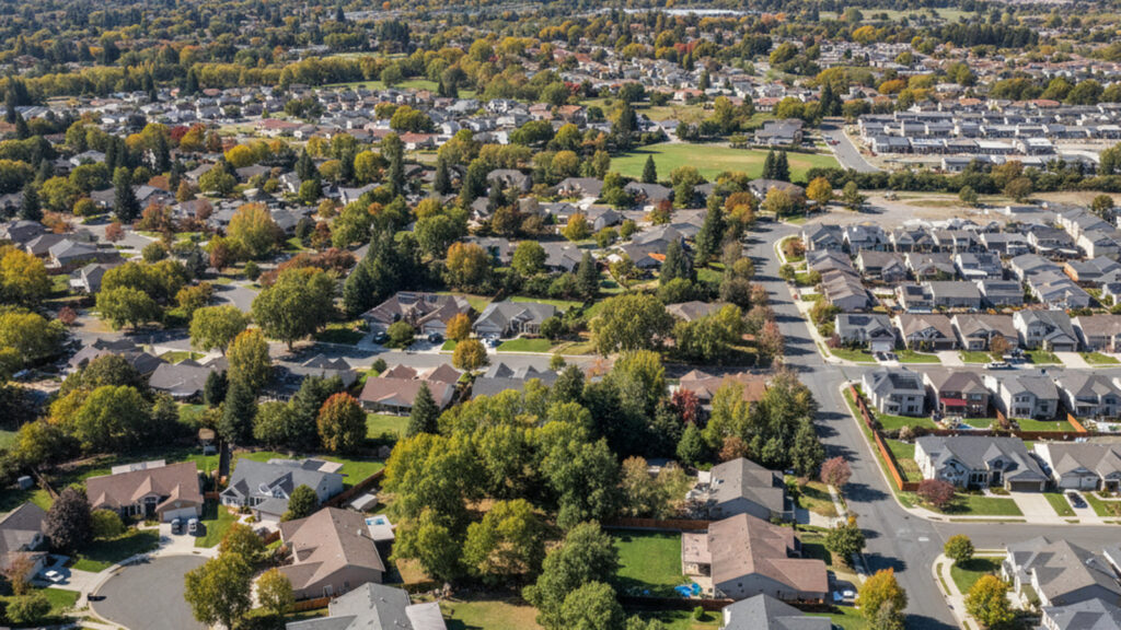
Roseville Real Estate Market and Property Values
The housing market in Placer County remains highly active heading into the spring of 2026. Median home prices in Roseville currently range from approximately $615,000 to $690,000, depending on the specific zip code and property condition.
The inventory largely consists of single-family homes, many of which are located within structured HOA communities. These planned developments often include their own neighborhood parks, community pools, and strict architectural guidelines.
The local economy supports these property values, with the median household income averaging around $97,000. Buyers must act decisively in this market, as properly priced homes with modern updates continue to attract multiple offers.
Roseville Joint Union High School District
Public education infrastructure is another major factor that anchors property values in the region. The area is primarily served by the Roseville Joint Union High School District and the Placer County R-1 School District.
These districts operate multiple campuses across the city, managing the educational needs of the growing population. Buyers frequently review school district boundaries during their home search to ensure a specific property aligns with their location requirements.
Frequently Asked Questions About Roseville, CA
Is Roseville, CA a wealthy area?
Roseville is generally considered an affluent suburb within the greater Sacramento region. The median household income is approximately $97,000, which is higher than many surrounding municipalities. This economic base supports the extensive retail and medical infrastructure found throughout the city.
Where is Roseville, CA located?
The city is located in Placer County, California, situated just northeast of the state capital. It sits along the I-80 corridor, roughly 20 miles from downtown Sacramento. This location places residents about two hours from the Bay Area and under two hours from Lake Tahoe.
What is the average cost of a house in Roseville?
As of early 2026, the median cost of a single-family home in the city ranges from $615,000 to $690,000. Pricing varies significantly based on the age of the subdivision and proximity to major amenities. Homes in newer master-planned communities typically command prices at the higher end of that spectrum.